Travel With Max Learn  •  Admire  •  Soar
ラーメラ塔の地層図
Fire in the Petersburg Suburb of RigaRiga's Petersburg Suburb Before the FirePostal StationView of Riga from the DaugavaModel of an 18th-c. Riga BargeStratigraphy Diagram of Rāmera TowerWeapons and Engravings from Great Northern WarThe Grand HallMilitary DrummerRiga Under Swedish RuleGuild Statute of the Riga Ropemakers’ GuildPowder Flask and Axe-Gun Combination

ラーメラ塔の地層図

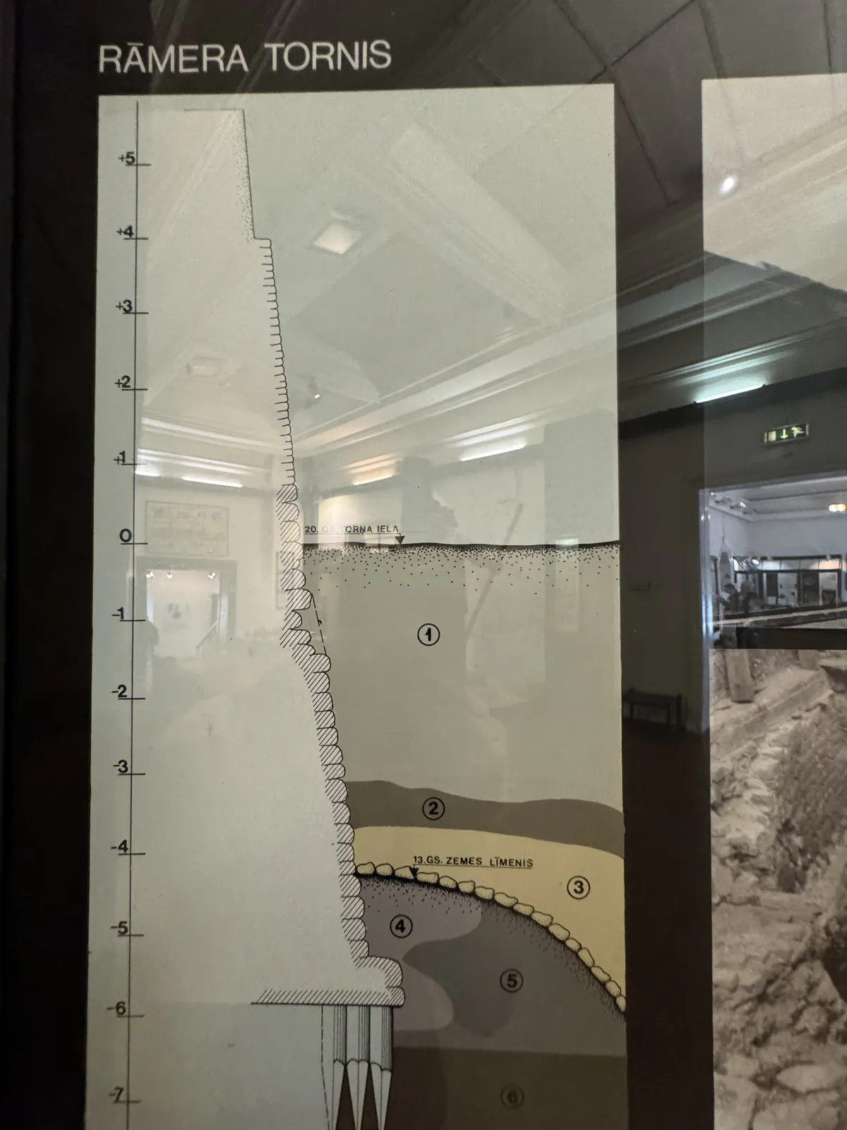
この図は、リガの中世防御施設の一部であるラーメラ塔の地下にある地層を示しています。発掘調査(1971~73年)により、次の層が確認されました。
1. 建設残土:建設または修理によるもの。
2. 有機物に富む層:それ以前の活動の痕跡。
3. 明るい色の砂層:地盤をならすためのものと考えられる。
4. 基礎溝:塔の基礎のために掘られた溝。
5. 灰色のローム層:締まった支持層。
6. 泥炭層:かつての湿地の名残。
7. 砂利層:安定した基盤。
この断面は、リガの防御施設が柔らかく層状になった地盤にどのように適応していたかを示している。
広告スペース

Want to reach Max with a question, collaboration idea, academic inquiry, media proposal, or a thoughtful note? Use the form below and your message will go directly to him.

AI検索