2024 © Maxim Tabachnik


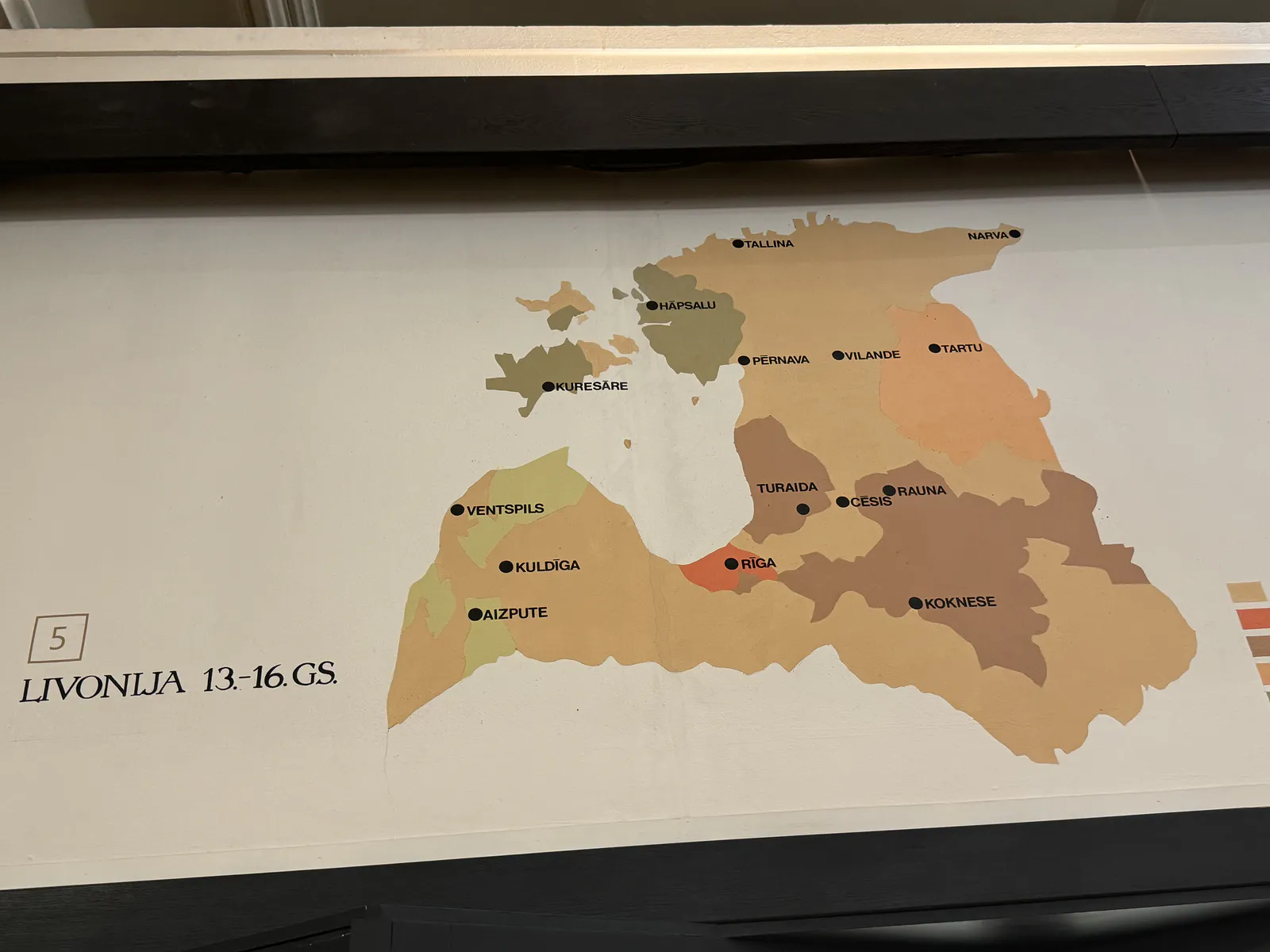
Medieval Livonia's Territorial Divisions
This map illustrates the territorial divisions of medieval Livonia (13th–16th cc.) post-Northern Crusades. Key cities like Riga and Cēsis were religious, political, and trade centers. The color scheme indicates authority layers: dark brown for Teutonic Order territories (after 1237), medium brown for bishoprics, gray-brown for local vassals, and orange-red for major urban centers. These divisions highlight Livonia's complex governance, balancing crusading, clerical, and local interests.
Popular categories
Advertising space